
The Redwood Shores Sea Level Rise Protection Project, led by the City of Redwood City, will protect homes, schools, businesses, and critical infrastructure by addressing flood risk identified by FEMA and projected future sea level rise. OneShoreline helped the City secure funding from FEMA for the project and is serving on the Technical Advisory Committee.
The project aims to:
- Select a preferred alternative for renewed FEMA accreditation
- Address future sea level rise and flooding risks
- Use nature-based solutions where conditions allow
- Enhance recreational amenities for the community
Project Background
The community of Redwood Shores, located largely in Redwood City (and areas of the City of San Carlos and San Mateo County), was built upon former marshes of San Francisco Bay beginning over 100 years ago. Redwood Shores is bounded by Belmont Slough to the north, San Francisco Bay to the east, Steinberger Slough to the south, and the U.S. 101 Highway to the west and protected by a system of levees. In 2010, Redwood City and its partners undertook its most recent project to raise the height of over three miles of levee surrounding the Redwood Shores to meet FEMA requirements.
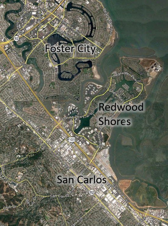
Because much of Redwood Shores is below high tide levels in San Francisco Bay, the current shoreline along the Redwood Shores peninsula is comprised of a combination of flood protection levees, setback levees, and high ground. The primary flooding hazard that threatens Redwood Shores is flooding from the Bayfront caused by high tides and storm events. With climate change, these hazards are expected to increase dramatically with sea level rise — not only putting Redwood Shores, but also the surrounding low-lying communities further inland, at significant risk. Based on the countywide Sea Level Rise Vulnerability Assessment completed by San Mateo County in 2018, during a 100-year event with 3.3 feet of sea level rise, Redwood Shores would be inundated entirely, U.S. Highway 101 would be overtopped, and portions of Woodside Road and downtown Redwood City would be inundated. Many critical assets are located in this floodplain, including San Carlos Airport, SamTrans South Base Maintenance and Bus Yard, Silicon Valley Clean Water Wastewater Treatment Plant, a fire station, two schools, as well as other private businesses.
In April 2020, FEMA notified the City of Redwood City that unless the levee system around Redwood Shores is modified to be eligible for accreditation by FEMA, the Flood Insurance Rate Map will be revised to indicate a coastal flood risk from a 100-year event and properties within Redwood Shores will be designated as a Special Flood Hazard Area (SFHA), subjecting approximately 4,700 households to a requirement to purchase flood insurance. The City is seeking to avoid this SFHA designation as well as to establish long-term resilience against sea level rise that would benefit the region.
To learn more about the project and sign up for the Project Newsletter, please visit the City of Redwood City’s website: Redwood Shores Sea Level Rise Protection Project