OneShoreline is developing resilient Public Infrastructure Guidance (PIG) to help local agencies plan, design, and maintain infrastructure that can perform reliably under changing climate conditions. The first version of the guidance, due to be released for public comment in the first half of 2026, will focus on stormwater systems, roads, and wastewater and water recycling facilities. In 2027, OneShoreline plans to release guidance for additional infrastructure—marinas, parks, open space, and utilities.
The new Public Infrastructure Guidance builds on OneShoreline’s 2023 Planning Policy Guidance, which helps cities and the County account for climate change-driven flooding, sea level rise, and groundwater rise in land use planning and private development. PIG extends this prior work with new guidance that incorporates similar future conditions thinking into the planning, design, and maintenance of the infrastructure we rely on for our communities to function.
How the guidance is being developed
The PIG is being developed in collaboration with Asset Advisory Groups made up of staff from local and state agencies, who bring local knowledge, on-the-ground experience designing and managing public infrastructure, and will be the primary users of the Guidance. OneShoreline will seek peer review prior to releasing a Public Draft, followed by opportunities for public review and comment before the final document is adopted by OneShoreline’s Board of Directors.
Why is the guidance needed?
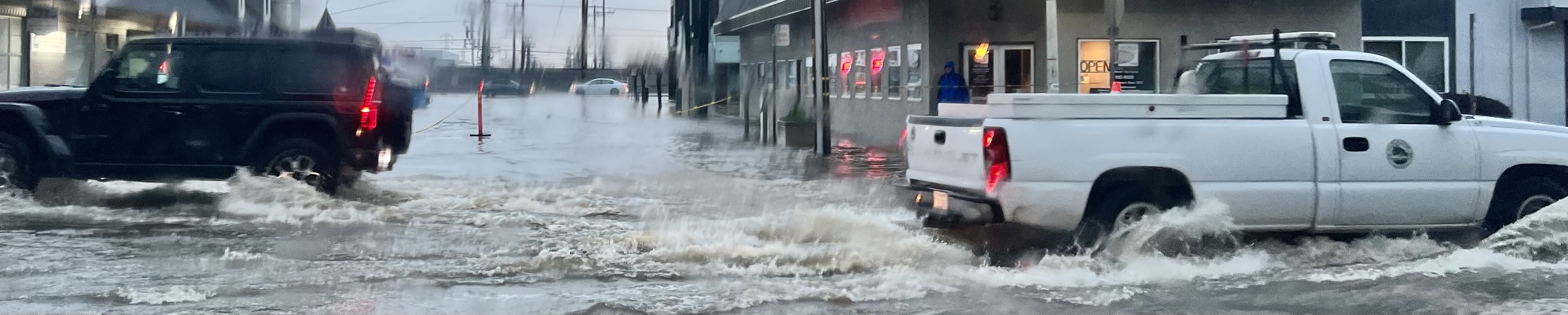
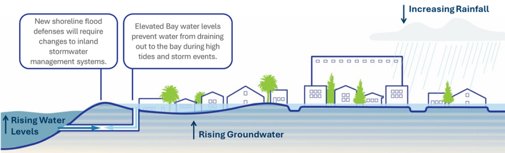
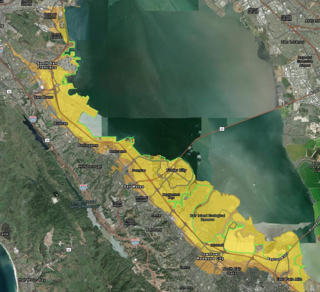
San Mateo County is experiencing more frequent and intense damage from climate change-fueled conditions. Flood risk in the county is driven by multiple, interconnected factors. Rising sea levels, heavier rainfall, and higher groundwater levels can interact to limit drainage and increase flooding inland, underscoring the need for coordinated, climate-informed infrastructure planning.
Why early planning matters
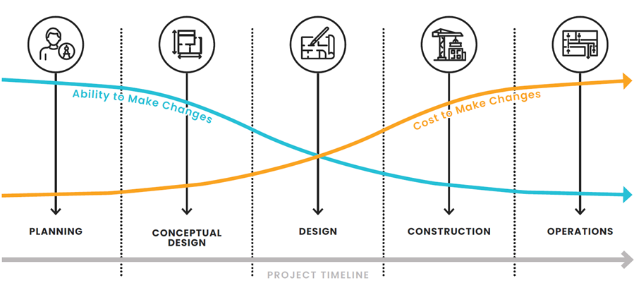
Many infrastructure decisions that affect long-term flood risk, cost, and performance are made early—during planning and conceptual design. As projects move into design, construction, and operations, the ability to make changes decreases while the cost of making changes increases. Providing clear, climate-informed guidance early helps agencies reduce long-term risks, avoid costly retrofits, and make more durable infrastructure investments.
Understanding Future Climate Conditions
Flood and storm risks in San Mateo County are changing as the climate warms. To develop guidance that reflects future conditions, OneShoreline is using regional climate research and local mapping tools to understand how rainfall, sea levels, and groundwater are expected to change over time, including:
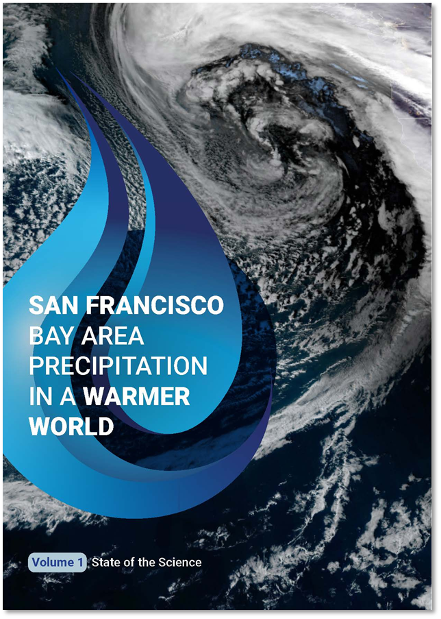
San Francisco Bay Area Precipitation in a Warmer World: Explains how climate change may affect rainfall patterns and extreme storms across the Bay Area. Through the Resilient Public Infrastructure Guidance, OneShoreline will generate San Mateo County-specific, publicly accessible rainfall and storm intensity information to support future-focused planning and design.
OneShoreline Map of Future Conditions: An interactive map that shows potential future flooding, sea level rise, and groundwater rise in San Mateo County.
These tools are designed to help residents, local agencies, and decision-makers better understand future risks and support informed conversations about resilience.
Who is this is for?
The PIG is intended for capital project planners and engineers in cities and towns, County agencies, special districts and utilities, transportation agencies, public works, engineering, planning, and operations staff, and partner organizations that support capital projects and resilience planning.
What will the guidance do?
This guidance is designed to help agencies move from “reactive repairs” to proactive, climate-informed decisions. This guidance is voluntary and designed to be practical and actionable for public agencies. It supports decision-making for public infrastructure and will continue to evolve as climate science, policy, and local experience change. It will:
- Integrate climate change into capital planning and design so projects account for future conditions, not just past trends.
- Develop San Mateo-specific climate science (including updated precipitation information and intensity-duration-frequency curves used to define design storms) to support local design standards.
- Provide practical infrastructure guidance with both general recommendations and asset-specific direction.
- Incorporate non-structural adaptation (policy, planning, operations, maintenance, and emergency management) alongside engineered solutions.
- Provide template language agencies can use in design manuals, standard specifications, and planning documents.
- Ensure alignment with policy and best available science while reflecting local priorities and constraints.
What “resilient” looks like in practice
Resilient infrastructure planning means making strategic choices based on:
- Climate scenario selection (future sea level rise, rainfall, groundwater, and storm conditions over an asset’s lifespan)
- Flood risk and consequences (what floods, how often, and what happens if it does)
- Asset criticality (evacuation routes, access to hospitals/fire/police, key utilities)
- Iterative planning and design (phased, adaptable decisions that can evolve with new data, funding, and community input)
- System performance under extreme storms (including atmospheric rivers)
- Feasible solutions (space constraints, environmental considerations, permitting, community needs)
The PIG will support decisions such as when to:
- Improve or expand stormwater conveyance and storage
- Elevate or protect road segments and facilities
- Create safer overflow pathways and “blue/green” corridors
- Use operational tools (monitoring, alerts, closures, maintenance triggers)
- Coordinate projects across agencies to maximize benefits and reduce disruption
- Leverage supportive policies, such as land use, household-scale adaptation programs, emergency response planning, etc.
Equity, access, and community benefits
Resilience solutions work best when they reflect local needs and priorities. This guidance will emphasize:
- Maintaining access to essential services during storms
- Reducing repetitive damage and long-term costs
- Supporting nature-based and multi-benefit solutions where feasible
- Clear communication and consistent standards across jurisdictions
Opportunities for feedback
We want this guidance to be practical and usable. Community members, practitioners, and partner agencies will have opportunities to provide input. We anticipate releasing the Public Draft for comment in Summer 2026.