Subscribe for Colma Creek Project Updates
Table of Contents
Project Background
All land is part of a watershed, and all individual watersheds are defined by rain. A watershed is an area of land that drains rain to a common body of water. This relationship is connected with the shape of land and the wellbeing of the natural and human communities that live there.
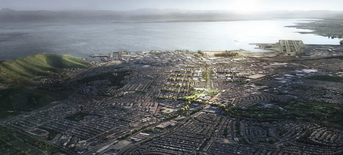
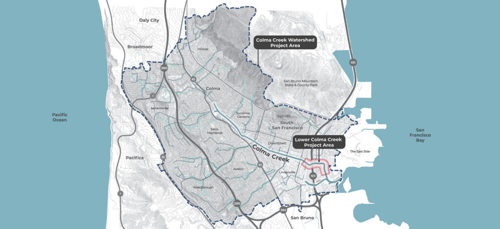
The Colma Creek Watershed spans approximately 16.6 square miles across San Bruno Mountain to Daly City, South San Francisco, Colma, Pacifica, and San Bruno down to the San Francisco Bay estuary.
Colma Creek Watershed’s History
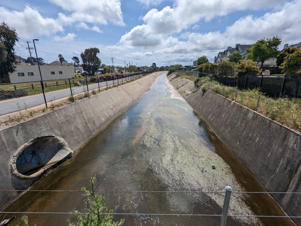
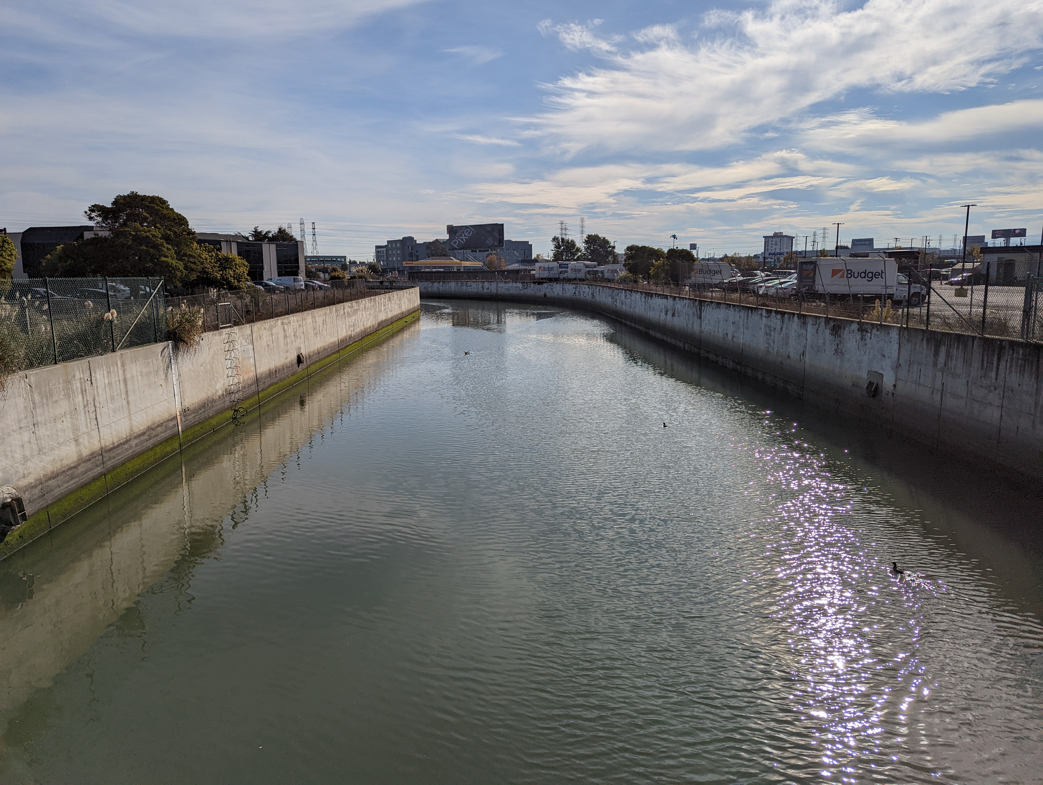
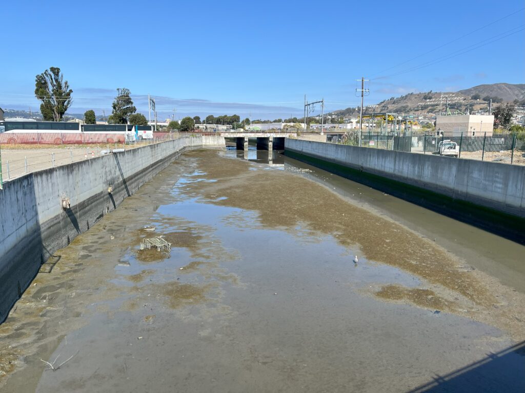
In the 1950s, the Colma Creek Watershed supported many marshes, mudflats, and upland areas that were important habitats to native species of plants and animals. Through the first half of the 20th century development increased, wetland and open waters were filled with soil, and between 1964 and 1978, concrete channel walls and bridges were constructed around Colma Creek to help manage flooding in surrounding areas and to make more space for development. However, this infrastructure was designed for past conditions and did not leave space for healthy natural systems.
The Watershed Today
When watersheds are mostly paved over, stormwater moves faster and cannot be absorbed, and flooding risk can increase. The current infrastructure has been aging and was not designed for higher tides and more intense rain events that are now more likely with climate change. Few wetlands remain, and trash and pollutants are concentrated in the Creek. Adaptation strategies and major improvements that incorporate nature-based solutions are now essential. This Plan presents an opportunity to improve the health of the watershed and transform Colma Creek into a community asset.
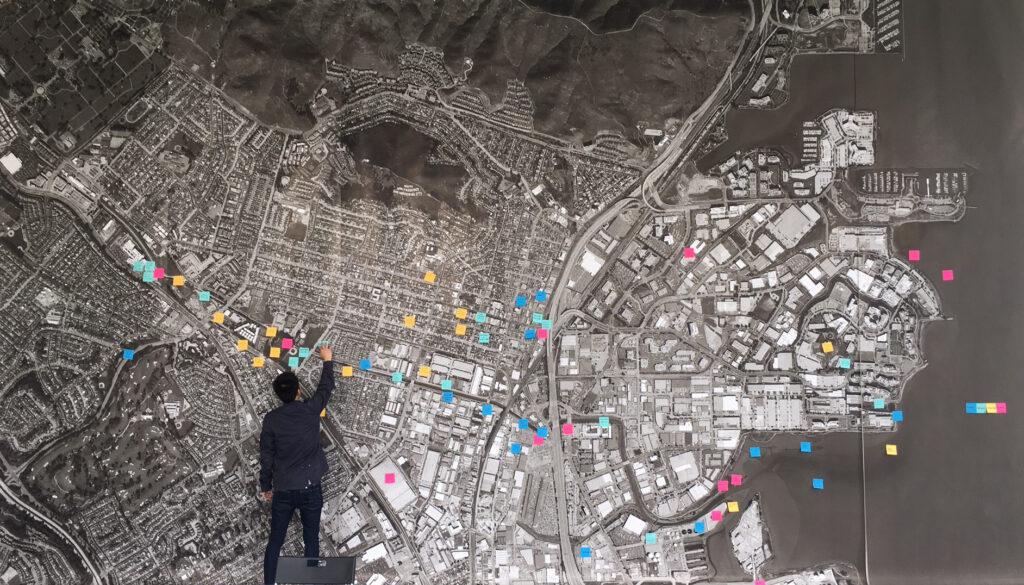
Community-Led Vision
Previous studies have explored opportunities and potential solutions for this area. The Colma Creek Watershed Plan is building on these local plans and studies to realize solutions to sea level rise and flooding challenges while increasing connections for the public and natural systems. This includes incorporating feedback from the public that was previously heard during projects including Resilient By Design (2018), the Colma Creek Adaptation Plan (2020), South San Francisco General Plan (2022), and the Lindenville Specific Plan (2023).
Previously heard community priorities include:
- New parks and open space, spaces to gather
- Increased access and recreation along Colma Creek
- New bike and pedestrian paths
- Preserving legacy of industrial uses and current business operations
- Transformation of Colma Creek to increase ecology and connection to the Bay
Project Overview
The Colma Creek Watershed Plan will serve as a blueprint to transform Colma Creek into a vital community asset nourished by a healthy watershed spanning approximately 16.6 square miles across San Bruno Mountain to Daly City, South San Francisco, Colma, Pacifica, and San Bruno down to the San Francisco Bay estuary.
The Watershed Plan will build on local plans and studies while advancing new strategies to address the pressing challenges of flooding and seal level rise. The work will identify and prioritize projects, programs, and policies that improve public health and safety, enhance habitat, improve water quality and supply, and expand public access and connection to the Creek, building on ideas and priorities expressed by community members that result in actions that reflect regional needs and local aspirations.
Project Objectives
Reduce flood risk through multi-benefit watershed solutions across the Colma Creek Watershed.
Create long-term resilience to climate change and improve water quality through policies, programs, and infrastructure that prioritizes nature-based solutions.
Connect Colma Creek to surrounding communities by increasing public access, recreational opportunities, and livability while improving public safety.
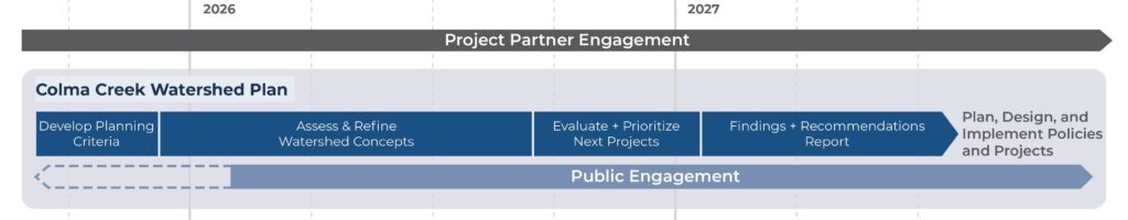
Project Timeline
This project is currently in the stage of analyzing the current conditions of the Plan area and previously explored solutions for feasibility and impact which is expected to continue through 2025. In 2026, potential concepts for the watershed will be collected and created. Once these potential concepts are drafted, the project team will engage with the public for further input and feedback.
Project Funding
The design phase of this project is funded through contributions from members of the Colma Creek Flood Zone (South San Francisco, Colma, Daly City, San Bruno, and Pacifica as well as unincorporated County areas). The endorsed Watershed Plan will be implemented through partner jurisdictions and through OneShoreline. Projects developed through this Plan are expected to result in multiple benefits eligible for funding from diverse sources.
Opportunities for Feedback
OneShoreline is committed to transparent, meaningful engagement through the Colma Creek Citizens Advisory Committee (CCCAC), regular partner meetings, and community events. OneShoreline convenes CCCAC meetings on a quarterly basis which are open to members of the public. See here for more information.
Sign up for the project mailing list below to receive updates about future engagement opportunities.
Questions?
Have a question or feedback? Email projects@oneshoreline.org
Stay Updated
Sign-up for the project newsletter below to receive ongoing updates.