Sea-level rise is heightening the risk of coastal flooding in communities throughout California, including the San Francisco Bay Area. A recent San Francisco Chronicle article identifies Redwood City as facing the highest risk for severe coastal flooding among all cities in the state. The article also features comments from Len Materman, CEO of OneShoreline, on the broader vulnerability of San Mateo County. See the April 4, 2025 article below for more details.
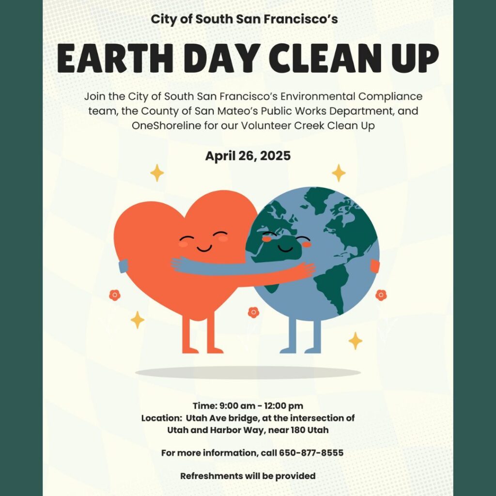
Join us for a Volunteer Creek Clean-Up Event at Colma Creek on Saturday, April 26, 2025!
The City of South San Francisco’s Environmental Compliance team, the County of San Mateo’s Public Works Department, and OneShoreline are coming together to help keep this important waterway clean—and we’d love for you to join us.
Bring your family and friends for a meaningful day of community service as we work to protect and restore Colma Creek. Every helping hand makes a difference!
Date: April 26, 2025 Time: 9 am – 12 pm Location: Utah Ave bridge, at the intersection of Utah and Harbor Way, near 180 Utah Refreshments will be provided.
“King Tide” is a non-scientific term used to describe exceptionally high tides that occur naturally and predictably at certain times of the year. These high water levels can lead to coastal flooding, particularly in low-lying areas. While King Tides are not directly linked to climate change, they provide a valuable preview of what our coastlines may look like with just 1 to 2 feet of sea level rise in the future.
Why Are King Tides Important?
King Tides help us visualize the potential impacts of rising sea levels, offering a glimpse of what could become more common in the years to come. Understanding how our coastlines respond to these extreme tides today is essential for planning and preparing for future changes.
Get Involved: Share Your Photos!
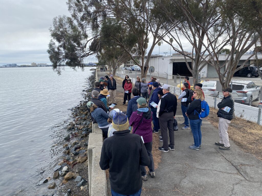
We invite you to help document the King Tides by taking photos and sharing them with the California King Tides Project, an initiative by the California Coastal Commission. Since 2018, this project has been building a statewide gallery of King Tide images that helps track the impacts of rising sea levels.
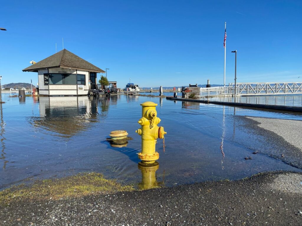
Oyster Point Marina, South San Francisco, 1/11/24 (Photo credits: California King Tides Project)
How to Participate:
Take Photos of the King Tides during the event (December 13-15) along the California coast.
OneShoreline is particularly interested in receiving photos from the following areas in San Mateo County:
Along the Bay Trail in Burlingame and Millbrae
Brisbane Marina
Ravenswood Open Space Preserve
Pacifica Pier
Oyster Point Marina and Pillar Point Harbor
Please pay attention to personal safety! Don’t turn your back to the ocean, and don’t drive through flooded roads. Also be aware that shorebirds may be further upland than usual during King Tides.
Your participation in this effort will help raise awareness about the potential challenges posed by sea level rise and contribute to important climate resilience planning for our communities.
Thank you for your involvement! Together, we can better prepare for the future of our coastline.
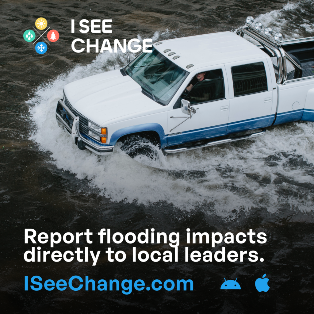
We are excited to introduce a new way for you to actively participate in addressing flooding challenges in San Mateo County! The San Mateo County Flood and Sea Level Rise Resiliency District (OneShoreline) has partnered with ISeeChange, a platform that empowers community members like you to document and share climate change impacts in your neighborhood.
Why Your Input is Crucial: This platform allows you to report flood events as they happen. Your contributions will play a vital role in helping OneShoreline validate flood models, identify the sources of flooding, and develop targeted solutions that reflect what’s truly happening on the ground.
How ISeeChange Works: Simply use the app or go to the website to record flooding you witness—whether it’s a heavy rain event, high tide, or unexpected street flooding. Each report will help us illustrate the scope and frequency of flooding across San Mateo County. This data will be instrumental in advocating for effective solutions and securing resources to better protect our communities.
Building Community Together: Beyond data collection, this platform is a space to foster connections among neighbors who share the experience of living in flood-prone areas. Explore reports from others in your neighborhood, learn about the impacts in surrounding areas, and engage with fellow residents to strengthen community bonds over shared experiences.
Start reporting: Add your observations whenever you notice flooding in your area.
Stay informed: Explore other community reports to see what’s happening nearby.
By participating, you are not only helping us build a clearer picture of local flooding, but you are also contributing to the larger effort of making San Mateo County more resilient to climate change. Together, we can make a difference!