Knock-On Flood Threat Gets 4-Inch Reality Check

Sierra Garcia | KneeDeep Times

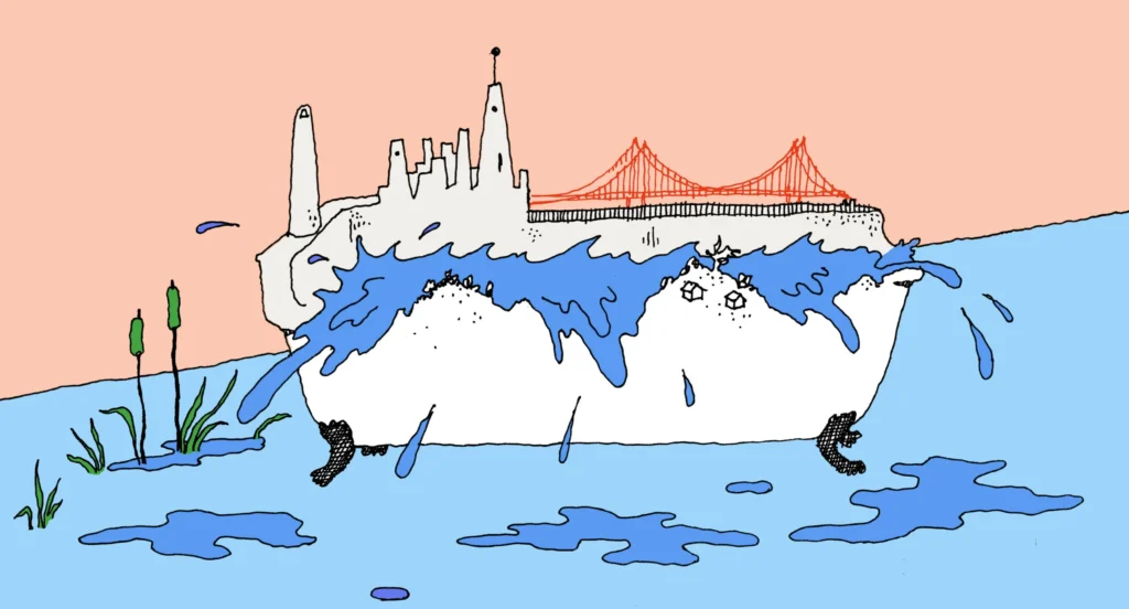
For years, sea level rise planning in the Bay Area has carried a dark asterisk: Protect your own city with caution, or your seawalls and levees might contribute to flooding your neighbors.

Fears of cross-bay flooding — or inadvertently foisting extra water onto parts of the San Francisco bayshore by defending other areas of shoreline from rising seas with flood walls — have taken on a life of their own in public discourse from San Rafael to the South Bay. But the magnitude of these redirected effects may be far smaller than the public imagines.

“The myth comes from the perspective of flood management along a river, when the narrow channel has little storage,” explains Matt Brennan, a senior engineering hydrologist with Environmental Science Associates, a firm involved in many local sea level rise adaptation projects. 

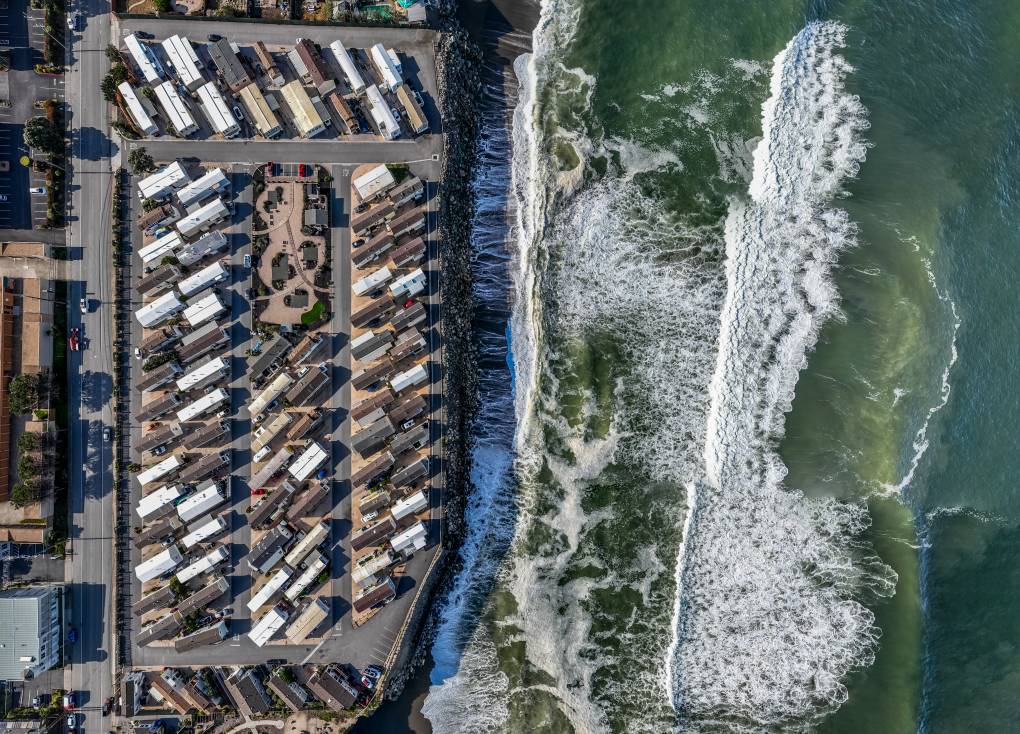
But the San Francisco Bay is not a river or a coastline pounded day in and day out by surf. The ancient riverbeds and valleys that determine the topography of the Bay shoreline allow water more room to spread out in some places than others. Around the edges, boundaries also vary, ranging from absorbent and gradual, like wetlands, to impervious and steep, like concrete seawalls.

Bayside flood barrier proposed from SFO to San Mateo

Nicholas Mazzoni | Daily Journal

An off-shore barrier is being proposed from SFO to as far south as Coyote Point to create a lagoon that would protect the shoreline from sea-level rise through doors that could close during large storms or extreme tides.

The proposal is by OneShoreline, the county’s Flood and Sea Level Rise Resiliency District, and its CEO Len Materman is making the rounds to various government agencies to explain the concept and gather feedback.

“OneShoreline was created to address huge problems that need huge solutions. I don’t want our legacy to do things on the margins. I want to address this issue,” Materman said.

The proposed off-shore barrier is still in the concept phase. However, if approved, the structure would connect from the San Francisco International Airport’s barrier it is constructing and would span from Millbrae as far south as Coyote Point on the San Mateo and Burlingame border, Materman said during a Burlingame City Council presentation Monday, Oct. 16…

California Mandates Coastal Cities Plan for Future Sea-Level Rise

Ezra David Romero | KQED

For the first time in California history, all coastal cities, including those in the Bay Area, must plan for sea-level rise, a looming climate impact yet to be fully experienced.

The new law — SB 272 — requires big cities like San Francisco and small towns like Strawberry along Richardson Bay to develop strategies and recommend projects to address future sea-level rise by 2034. While seas have risen only about 8 inches since the 1880s, the ocean and the bay could rise by about a foot by midcentury — thanks mainly to human-caused climate change.

Sen. John Laird (D-Santa Cruz) authored the bill recently signed into law by Gov. Gavin Newsom. The governor vetoed a similar bill last fall, noting budget constraints. Laird said his team worked with Newsom’s office to ensure there are dollars in the budget for local planning on sea-level rise. California’s final budget included $1.1 billion in investments for coastal resilience programs over multiple years…

A mobile home park in Northern California sits just feet from the Pacific Ocean. (Jason Doiy/Getty)

New Flood Protection Standard for the Peninsula

Meg Duff | KneeDeep Times

By the end of the century, the State of California is projecting between one foot and ten feet of sea level rise. In San Mateo County, new planning guidance may help cities account for rising seas when approving new developments. 

“Incorporating future conditions requires a really, really big perspective shift,” said Makena Wong, a project manager who worked on the guidance, in a recent public meeting. “We’re trying to make that shift as practical as possible.”

The new guidance is voluntary. It comes from OneShoreline, a countywide flood and sea level rise resiliency district, and includes maps and templated language that cities can use in general plans, specific plans, and zoning laws. OneShoreline can help cities with implementation. Residents can also ask the organization to comment on whether proposed developments meet the new standards…

A new development nears completion, located proximate to a tidally-influenced reach of Pulgas Creek. During heavy rains, the City of San Carlos pump station works overtime.

San Mateo County experts prep for sea-level rise

Sierra Lopez | Daily Journal staff

OneShoreline, San Mateo County’s flood and sea-level rise resiliency district, has unveiled a planning guidance document meant to help cities along the Bay craft local policy as new development is proposed on the vulnerable shore.

“This represents a tremendous amount of work by the staff and I know that you have given it a lot of thought and attention,” said Dave Pine, president of the Board of Supervisors and chair of OneShoreline’s Board of Directors, during a meeting April 24. 

OneShoreline’s Planning Guidance Policy to Protect and Enhance Bay Shoreline Areas of San Mateo County, crafted by OneShoreline staff and consultants with Good City Company, is meant to be a resource for the 12 cities either directly lining the Bay or affected by it and those who are interested in engaging in discussions around sea-level rise and resiliency…

An underground culvert to divert excess flow from Atherton Channel and Bayfront Canal into managed ponds within the Ravenswood Complex of the South Bay Salt Pond Restoration Project.

San Mateo County’s New Sea Level Rise Plan Calls for a 100-Foot Buffer Zone for Shoreline Development

News Article by Ezra David Romero | KQED

San Mateo County released first-of-its-kind sea level rise guidance today, a forceful planning document meant to slow a bonanza of shoreline development and protect a dozen communities from climate-driven flooding near San Francisco Bay, including from rising groundwater and catastrophic flooding during storms.

The voluntary guidance asks that any new development along the county’s 53 miles of bayshore be constructed above today’s high tide by around 10 feet in an effort to protect businesses and residents.

The plan would also establish a 100-foot buffer zone between future developments and the bay and set new buildings 35 feet back from creeks.

“We’re not familiar with any [other guidance] that’s this specific and this aggressive on climate flooding,” said Len Materman, CEO of OneShoreline, San Mateo County’s flood and sea level rise resiliency district…

Wetlands of San Mateo County offer natural flood protection for neighborhoods of East Palo Alto. (JJ Harris/Techboogie/KQED)

New Study Finds Rising Groundwater Is a Major Bay Area Flooding Risk

News Article by Ezra David Romero | KQED

As recent storms have shown just how vulnerable the Bay Area is to flooding, a new study finds that rising groundwater is a crucial contributor to the region’s flooding challenges.

The study’s goal in four counties — Alameda, Marin, San Francisco, and San Mateo — is huge.

“It’s to make the Bay Area the most climate-resilient coastal region in the world,” said Adrian Covert, senior vice president of the Bay Area Council, a business association that helped fund the research.

In partnership with local climate scientists at Pathways Climate Institute, the San Francisco Estuary Institute, UC Berkeley, regional agencies and the counties, the study took existing groundwater levels and imagined how they would push up around the lip of the bay as seas rise. The authors also created maps to provide a high-level overview of this challenge…

A king tide floods China Camp in San Rafael, on New Year’s Day, 2018. (Cindy Pavlinac/Flickr)

San Mateo County Pieces Falling Into Place

News Article by Cariad Hayes Thronson | KneeDeep Times

To a traveler arriving in the Bay Area by air, the vulnerability of San Francisco International Airport (SFO) to rising seas is alarmingly apparent. Gazing out of the window as the plane touches down on a runway that juts into San Francisco Bay, the traveler can see the waves lapping just a few feet below.

“When you look at future sea level rise scenarios, the entire airport property, runways and facilities, could be inundated,” says SFO’s Doug Yakel. The existing protection system, which consists of vinyl sheet pile walls, concrete seawalls, and concrete-capped earthen berms, “was designed to protect against wave action during stormy weather. It really wasn’t designed to protect against an aggregate increase in the level of our seas.” Yakel notes there are also entire sections of the airport waterfront with no protection at all, including the water treatment facility and the US Coast Guard station.

But a plan to fortify the airport, which encompasses eight miles of Bay shoreline between South San Francisco and Millbrae, is gaining momentum. In October, the San Francisco Planning Department released a Draft Environmental Impact Report for SFO’s Shoreline Protection Program, which will protect the airport against an extreme 100-year tide and 42 inches of sea-level rise. More than that, the plan is shaping up to become a critical link in a chain of resilience projects strung along the county’s bayshore.

Evolving multi-jurisdiction adaptation strategy for the San Mateo County bayshore, with grey zone indicating projected sea-level rise. Map: Amber Manfree.

Sea level rise work begins in Burlingame and Millbrae

News Article by Corey Browning | Daily Journal

A groundbreaking plan to construct a comprehensive network of seawalls and levees to protect the Peninsula from sea level rise took a major step forward this week, with design work for the Burlingame and Millbrae portion of the undertaking officially underway.

The stretch of infrastructure will be the first major project for OneShoreline, the county’s new agency tasked with a holistic approach to rising waters expected as a result of climate change. The agency received $8 million from the state budget last year, half of which will go directly to the Burlingame-Millbrae project.

“We quite literally are on the front line of climate change and dealing with the impacts,” said Assemblymember Kevin Mullin, D-South San Francisco, who secured the earmark. “This investment will help protect local and regional assets ranging from homes, local businesses and corporate campuses to SFO … as well as BART and Caltrain and other critical infrastructure.”

OneShoreline Board Chair Dave Pine (left) receives a check from Assemblymember Kevin Mullin with San Francisco International Airport in the background.