Have you captured photos of flooding in San Mateo County? OneShoreline would love to see them!

Since last fall, OneShoreline has been partnering with ISeeChange to gather real-time reports of flooding throughout San Mateo County. As the rainy season comes to a close, we’re now also seeking historic flood photos to help us better understand where flooding has occurred over the years.

ISeeChange is a community-driven platform that enables residents to document and share how climate change affects their neighborhoods. Their team will analyze both current and past flood photos to gather insights that will support future flood resilience efforts and guide planning across San Mateo County.

Share your photos of flooding here: https://www.iseechange.com/campaigns/san-mateo

New Research on Coastal Flood Risk in San Mateo County

Sea-level rise is heightening the risk of coastal flooding in communities throughout California, including the San Francisco Bay Area. A recent San Francisco Chronicle article identifies Redwood City as facing the highest risk for severe coastal flooding among all cities in the state. The article also features comments from Len Materman, CEO of OneShoreline, on the broader vulnerability of San Mateo County. See the April 4, 2025 article below for more details.

Join Us for an Earth Day Creek Cleanup!

Join us for a Volunteer Creek Clean-Up Event at Colma Creek on Saturday, April 26, 2025!

The City of South San Francisco’s Environmental Compliance team, the County of San Mateo’s Public Works Department, and OneShoreline are coming together to help keep this important waterway clean—and we’d love for you to join us.

Bring your family and friends for a meaningful day of community service as we work to protect and restore Colma Creek. Every helping hand makes a difference!

Date: April 26, 2025
Time: 9 am – 12 pm
Location: Utah Ave bridge, at the intersection of Utah and Harbor Way, near 180 Utah
Refreshments will be provided.

For more information, please call 650-877-8555.

New article about the Millbrae and Burlingame Shoreline Resilience Project

KneeDeep Times, the Bay Area’s Climate Resilience Magazine, has published a new article about the Millbrae and Burlingame Shoreline Resilience Project led by OneShoreline. You can access the article here: https://www.kneedeeptimes.org/high-concept-plans-for-a-high-risk-shoreline. Additional information about the project is available on OneShoreline’s website.

OneShoreline staff giving members of the community a walking tour of the Millbrae and Burlingame Shoreline Resilience Project in November 2024.

King Tides are Coming to California this weekend (December 13-15, 2024)!

What are King Tides?

“King Tide” is a non-scientific term used to describe exceptionally high tides that occur naturally and predictably at certain times of the year. These high water levels can lead to coastal flooding, particularly in low-lying areas. While King Tides are not directly linked to climate change, they provide a valuable preview of what our coastlines may look like with just 1 to 2 feet of sea level rise in the future.

Why Are King Tides Important?

King Tides help us visualize the potential impacts of rising sea levels, offering a glimpse of what could become more common in the years to come. Understanding how our coastlines respond to these extreme tides today is essential for planning and preparing for future changes.

Get Involved: Share Your Photos!

We invite you to help document the King Tides by taking photos and sharing them with the California King Tides Project, an initiative by the California Coastal Commission. Since 2018, this project has been building a statewide gallery of King Tide images that helps track the impacts of rising sea levels.

Oyster Point Marina, South San Francisco, 1/11/24
(Photo credits: California King Tides Project)

How to Participate:

  1. Take Photos of the King Tides during the event (December 13-15) along the California coast.
  2. Upload Your Photos to the California King Tides Project website. Follow this link for submission instructions.
  3. Join a King Tides event organized by the California King Tides Project. Find a time and location that works for you.

Focus Areas in San Mateo County

OneShoreline is particularly interested in receiving photos from the following areas in San Mateo County:

  • Along the Bay Trail in Burlingame and Millbrae 
  • Brisbane Marina 
  • Ravenswood Open Space Preserve 
  • Pacifica Pier  
  • Oyster Point Marina and Pillar Point Harbor 

Please pay attention to personal safety! Don’t turn your back to the ocean, and don’t drive through flooded roads. Also be aware that shorebirds may be further upland than usual during King Tides. 

Your participation in this effort will help raise awareness about the potential challenges posed by sea level rise and contribute to important climate resilience planning for our communities.

Thank you for your involvement! Together, we can better prepare for the future of our coastline.

Introducing a New Platform to Track Climate Change Impacts in San Mateo County

We are excited to introduce a new way for you to actively participate in addressing flooding challenges in San Mateo County! The San Mateo County Flood and Sea Level Rise Resiliency District (OneShoreline) has partnered with ISeeChange, a platform that empowers community members like you to document and share climate change impacts in your neighborhood.

Why Your Input is Crucial:
This platform allows you to report flood events as they happen. Your contributions will play a vital role in helping OneShoreline validate flood models, identify the sources of flooding, and develop targeted solutions that reflect what’s truly happening on the ground.

How ISeeChange Works:
Simply use the app or go to the website to record flooding you witness—whether it’s a heavy rain event, high tide, or unexpected street flooding. Each report will help us illustrate the scope and frequency of flooding across San Mateo County. This data will be instrumental in advocating for effective solutions and securing resources to better protect our communities.

Building Community Together:
Beyond data collection, this platform is a space to foster connections among neighbors who share the experience of living in flood-prone areas. Explore reports from others in your neighborhood, learn about the impacts in surrounding areas, and engage with fellow residents to strengthen community bonds over shared experiences.

Get Started Today:

  1. Download the ISeeChange app on Google Play or Apple App Store
  2. Start reporting: Add your observations whenever you notice flooding in your area.
  3. Stay informed: Explore other community reports to see what’s happening nearby.

By participating, you are not only helping us build a clearer picture of local flooding, but you are also contributing to the larger effort of making San Mateo County more resilient to climate change. Together, we can make a difference!

Enhancing the Countywide Flood Early Warning System as the First Storm of the Year Arrives

San Mateo County faces a significant flood risk due to the concentration of developed areas within the floodplain and less developed areas that are subject to erosion. During major storms, many communities worry about nearby creeks rising quickly and overtopping, a problem that is exacerbated when tides are high and getting higher with sea level rise, and storms are more intense due to climate change. During storm events, like those this week, the need for clear and credible information so the emergency responders and the general public can make informed decisions has never been greater.

The newly-installed El Zanjon stream monitoring station, near San Bruno Creek
(Colin Martorana, October 2020)

This is why one of the top priorities for the District during its first year was to expand and enhance the existing stream gauges in several of our most flood-prone waterways throughout the county. With a Statewide Emergency Response Grant from the California Department of Water Resources, this past fall, the District has focused on stream monitoring stations on Colma Creek, San Bruno Creek, San Mateo Creek, Belmont Creek, and Atherton Channel. Beginning with the storms in January 2021, these stations provide data on rainfall and real-time in-channel conditions so the District and our partners can estimate when and where flooding will occur in six cities and unincorporated areas of San Mateo County.

The process to determine each station’s location must strike a balance between being sufficiently upstream to provide ample warning to a downstream area subject to flooding, but sufficiently downstream to capture a significant portion of the watershed’s drainage area. It also can be advantageous to monitor water level over a particular window of time, especially where tides may influence flooding. This week, the District has also installed temporary gauges to work in tandem with the permanent ones to help calibrate the expected flows relative to rainfall and tides, so that we may better understand and predict the potential for overtopping and flooding.

Before this winter is over, we aim to build a webpage on our website, OneShoreline.org, that provides this information in a quickly accessible manner to the general public. And once the flood early warning webpage is fully operational, emergency personnel and the community can subscribe to receive flood condition notifications via text or email. The stations’ data may be used to inform the County’s SMCAlert network, and the page will serve as a centralized resource for live storm monitoring and preparation information throughout the county.

Stay tuned for updates on our project’s webpage here.

Aligning and Advancing Adjacent but Distinct Efforts to Address Sea Level Rise Along the Bay Shoreline of Burlingame, Millbrae, and SFO

In late 2019 and early 2020, the cities of Burlingame and Millbrae completed separate efforts to analyze their flooding risk resulting from both sea level rise in San Francisco Bay (Bay) and precipitation from major storms. Within these studies, each developed and screened strategies to protect communities adjacent to the Bay shoreline and the major creeks that flow to it. Meanwhile, over the past several years, San Francisco International Airport (SFO) has developed a Shoreline Protection Program to protect the entire perimeter of the Airport from sea level rise.

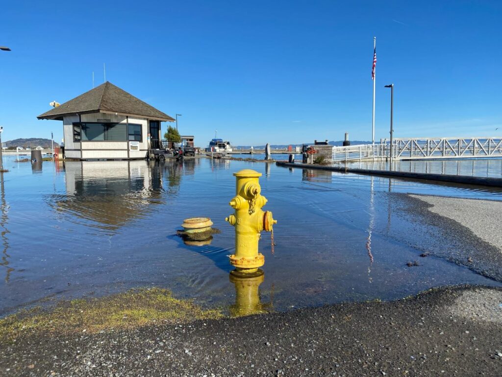
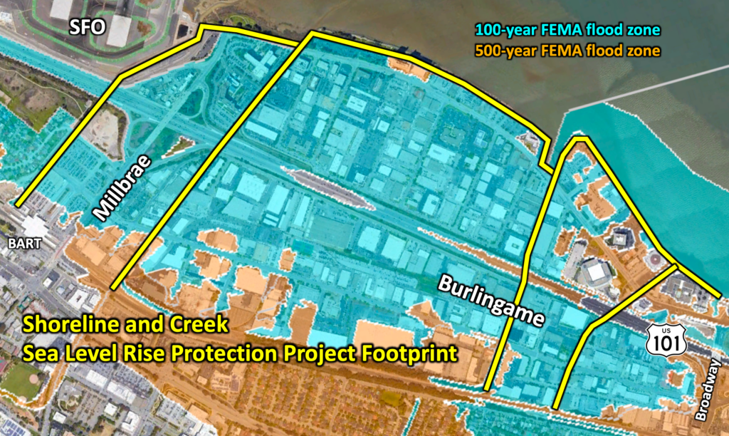
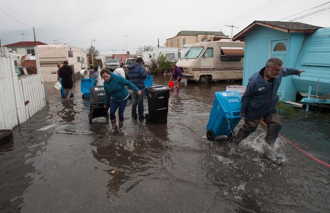
Large areas of both cities (and the entirety of SFO) are projected to be inundated during the current FEMA 100-year event plus approximately 6 feet of sea level rise. Many regionally significant assets are located in this floodplain, including electrical distribution facilities, a regional commuter rail corridor and intermodal transportation center, regional water treatment plant, hazardous material sites, many major hotels and other businesses, U.S. Highway 101, and of course, SFO. In addition, other studies completed by San Mateo County explored flooding emanating from areas within Millbrae and SFO property affecting inland areas in the City of San Bruno (particularly, the Belle Air neighborhood) that were recently mapped into the FEMA 100-year floodplain. This project’s regional approach also allows for protection to these disadvantaged inland areas.

The District is partnering with the City of Burlingame, City of Millbrae, and SFO Airport to align, connect, and advance their efforts in a coordinated way, rather than each jurisdiction continuing to spend time and money on independent studies that cannot fully address this monumental regional challenge. Last fall, these project partners, with the City of Burlingame serving as the grant applicant, applied for federal funding under the new FEMA Building Resilient Infrastructure and Communities (BRIC) grant program to support the early steps in the project, including data collection, community outreach, and an alternatives analysis.

In the long-term, the project objective is to raise shoreline and creek bank elevations along 1.6 miles of Bay shoreline and 1.5 miles of creeks (shown in yellow on the figure below) to remove properties from the current FEMA 100-year floodplain plus approximately 6 feet of sea level rise – a Bay water level approximately 10 feet above today’s daily high tide.

In line with the District’s core principles, the project team will take a holistic approach to objectives by seeking to incorporate environmental, recreational connectivity, and community-building considerations into its evaluation of alternatives.

Constructing the $8.6 million Bayfront Canal-Atherton Channel Project to protect people and property from frequent flooding

Atherton Channel converges with the Bayfront Canal near the border between Redwood City and Menlo Park, and empties into San Francisco Bay through a tide control structure not far from Bedwell Bayfront Park. For the past several decades, even minor rainfall events that coincide with a high tide caused water in the Channel and Canal to back up and flood mobile home parks and businesses in the area.

Residents at the Le Mar Trailer Park in Redwood City during December 2014 flooding
(John Green/Bay Area News Group)

In response to this proven threat, the District is leading a project that partners with Redwood City, Menlo Park, Atherton, and San Mateo County, with over $1.1 million in support from the State, to install an underground culvert to divert stormwater into former salt ponds owned by the U.S. Fish & Wildlife Service. This project’s new outlet for high flows during high tides will reduce the frequency and amount of flooding, thereby reducing costs and improving public health and safety, and its new trash capture device will improve water quality in the Bay. The public agencies partnering on this project intend for it to be the first of several within this 5,500 acre watershed. In a related effort as part of a countywide early warning system, the District is installing a device to monitor streamflow in Atherton Channel at the Caltrain tracks in order to provide advance notification of potential flooding downstream to the public and emergency responders.

Throughout October, the agreement to secure $8.6 million for the project’s construction, operations, maintenance, and mitigation, and agreements for necessary easements, will be discussed at meetings of the governing bodies of the partner agencies, with the goal of beginning construction in early 2021.

Keep up to date on this effort on our project webpage.