Project Overview
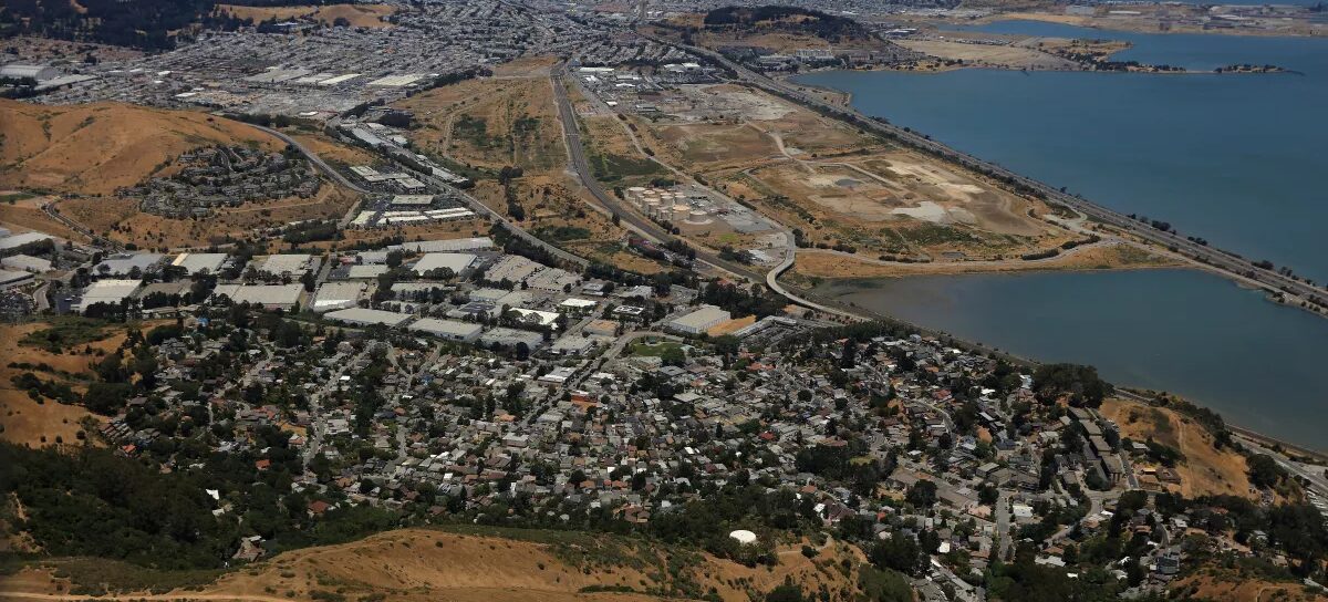
The Brisbane Shoreline Resilience Plan is a two-year planning effort led by OneShoreline and the City of Brisbane. The plan will identify ways to reduce flood risk from sea level rise while protecting community assets, public access, natural habitats, and critical infrastructure along Brisbane’s 1.5-mile shoreline on San Francisco Bay.
The plan is being developed in coordination with neighboring cities and regional agencies so that shoreline protection efforts work together across boundaries.
Why This Plan Is Needed?
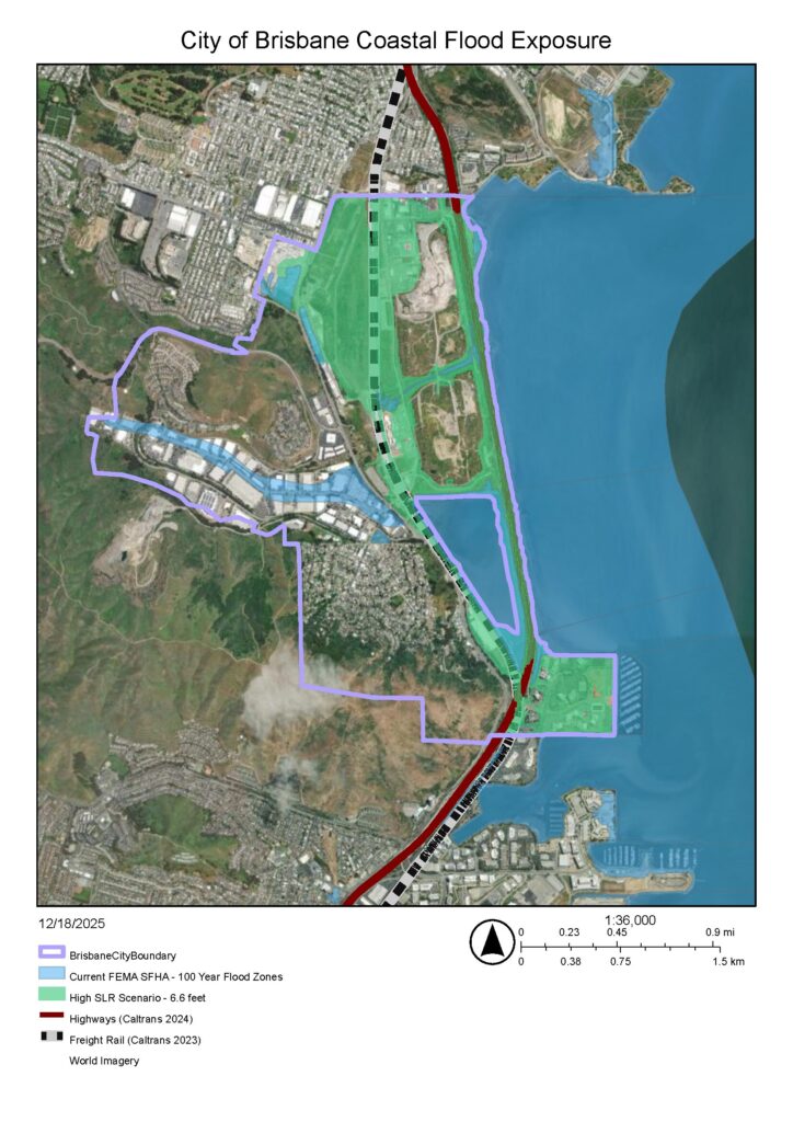
Sea level rise is increasing the risk of flooding along the San Francisco Bay shoreline. To help communities prepare, California passed Senate Bill 272 (SB 272) in 2023. This law requires cities and counties along the Bay and the coast to develop sea level rise adaptation plans by January 1, 2034. Projects identified in approved adaptation plans are better positioned to compete for state funding, creating incentives for early plan adoption.
For cities that are next to the San Francisco Bay, the San Francisco Bay Conservation and Development Commission (BCDC) provides guidance through its Regional Shoreline Adaptation Plan (RSAP), which helps ensure that local shoreline adaptation plans are consistent, coordinated, and based on the best available science.
The Brisbane Shoreline Resilience Plan will meet SB 272 requirements and follow BCDC’s RSAP guidance.
About Brisbane’s Shoreline
Brisbane is located between the City and County of San Francisco and the City of South San Francisco. Its shoreline includes important regional and community assets, including:
- U.S. Highway 101 and associated transportation infrastructure
- Caltrain tracks
- Natural gas and electrical transmission lines
- Wastewater pump stations
- Brisbane Marina
- Brisbane Lagoon
The Brisbane Lagoon, created during construction of U.S. Highway 101, provides stormwater detention for the city and supports fish and bird habitat and recreational uses.
What the Plan Will Do?
The Brisbane Shoreline Resilience Plan will focus on improving flood protection for low-lying developed areas, infrastructure, trails, coastal habitats, and open spaces.
The plan will build on earlier studies and adopted plans, including the Brisbane Lagoon Watershed Sea Level Rise Adaptation Plan and Baylands Specific Plan.
Key parts of the plan include:
- Updating flood risk and vulnerability information using the latest sea level rise guidance
- Identifying adaptation strategies for the 2050 and 2100 timeframes
- Engaging the community throughout the planning process
- Identifying priority projects, land use policies, funding options, and an implementation roadmap
Regional Coordination
Sea level rise does not stop at jurisdictional boundaries. To ensure coordinated and effective adaptation, OneShoreline and the City of Brisbane will work closely with regional agencies and implementation partners, including Caltrans, the City of South San Francisco, and the City and County of San Francisco. Additional partners will be engaged as the project advances to help align shoreline strategies at a regional scale.
Nature-Based Solutions
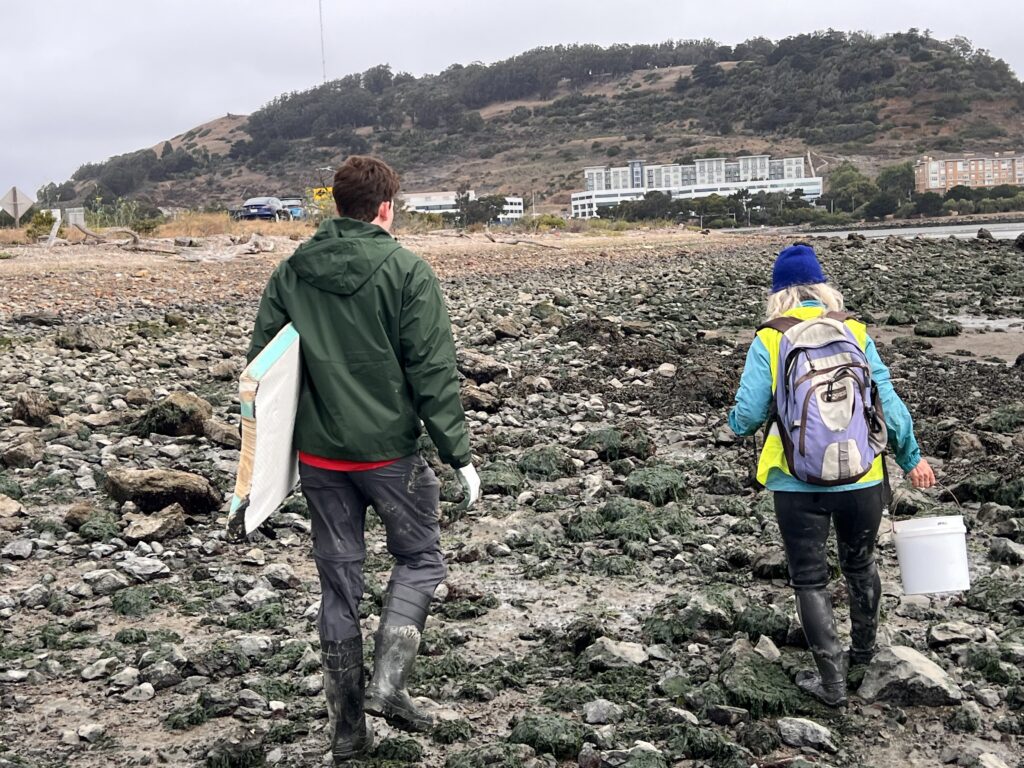
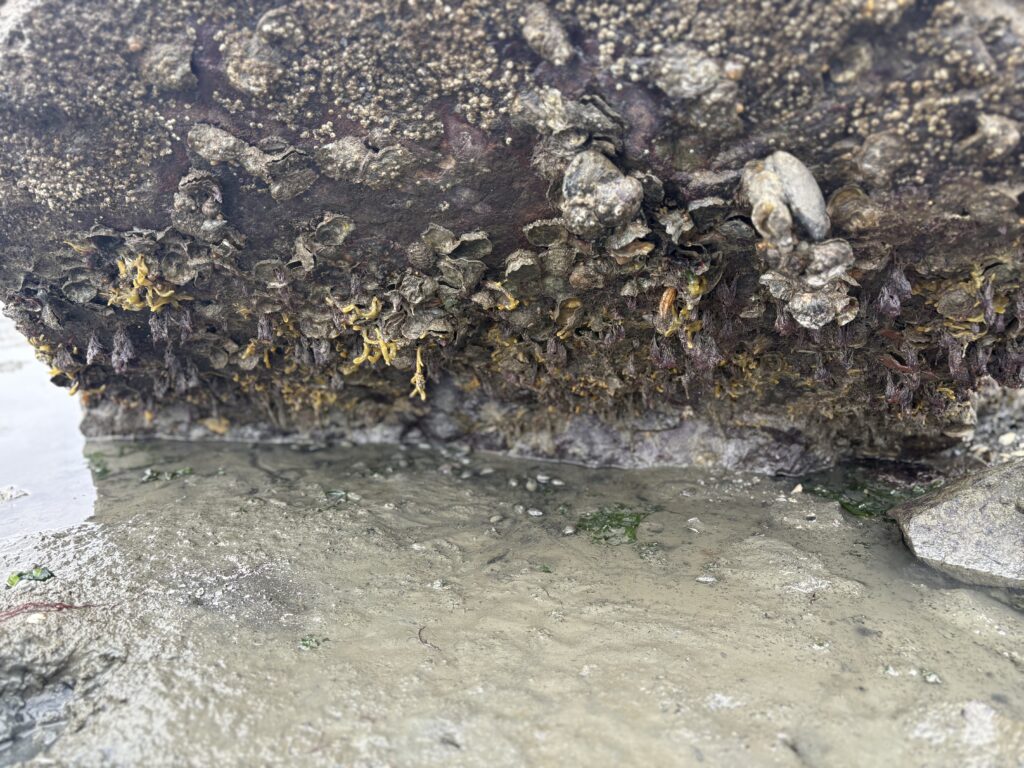
Where feasible, the Brisbane Shoreline Resilience Plan will prioritize nature-based adaptation strategies. These approaches use natural systems—such as wetlands, eelgrass, and oyster reefs—to reduce flood risk while improving habitat and environmental health.
The Plan will be informed by regional science and guidance, including the San Francisco Estuary Institute’s Shoreline Adaptation Atlas and BCDC’s RSAP Atlas, to identify preliminary nature-based strategies for Brisbane’s shoreline conditions.
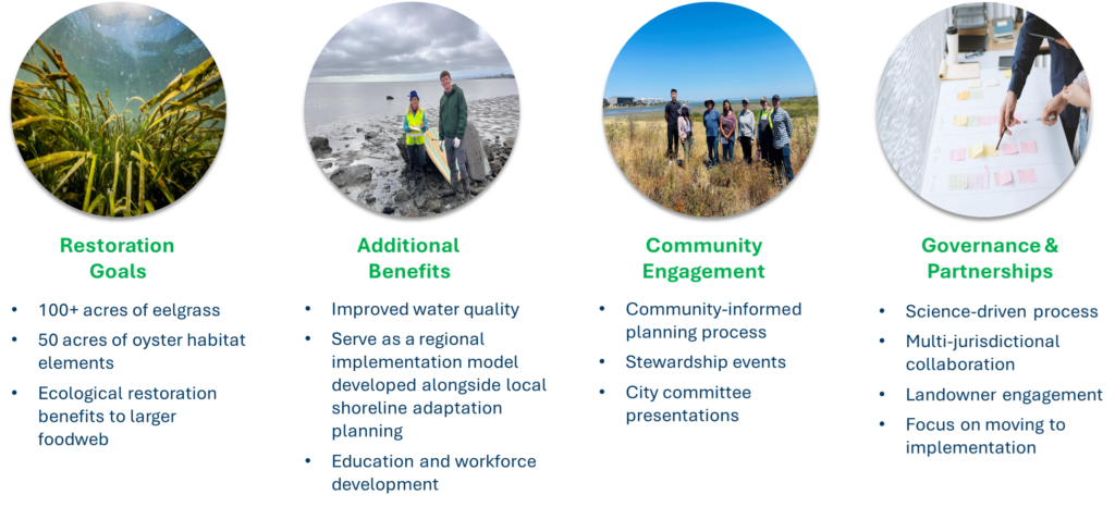
Brisbane Living Shoreline
In parallel with this planning effort, OneShoreline has applied to the San Francisco Bay Restoration Authority for Measure AA funding for the Brisbane Living Shoreline to complement the adaptation strategies identified in the plan. This project has been adopted by the San Francisco Bay Joint Venture as a regional priority for living shoreline restoration.
Working with project partners, including researchers from the Smithsonian Environmental Research Center (SERC), San Francisco Bay National Estuarine Research Reserve (NERR), and San Francisco State University’s Estuary and Ocean Science (EOS) Center, this effort aims to restore eelgrass and oyster habitat along the Brisbane shoreline adjacent to U.S. Highway 101.
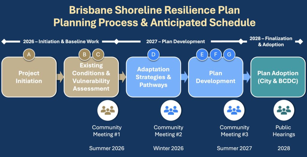
Project Timeline
Development of the Brisbane Shoreline Resilience Plan is expected to take approximately two years. The plan will ultimately be adopted by the City of Brisbane before advancing to consideration by the San Francisco Bay Conservation and Development Commission (BCDC).
Project Funding
The Brisbane Shoreline Resilience Plan is funded by a $750,000 grant from the California Ocean Protection Council’s SB 1 Sea Level Rise Adaptation Planning Program, with a $200,000 local match provided by OneShoreline.
Opportunities for Community Feedback
Community engagement is a core part of the Brisbane Shoreline Resilience Plan. Opportunities to participate will include public meetings and other events where community members can:
- Learn about Brisbane’s flood-related climate risks
- Share local knowledge and priorities
- Explore potential adaptation strategies
- Provide input on the draft plan
The project team will also regularly present to Brisbane’s Sea Level Rise Subcommittee, Planning Commission, and Open Space and Ecology Committee.
More information about engagement opportunities will be available in 2026.
Questions or Comments?
If you have questions or would like to share feedback, email projects@oneshoreline.org